New England Population Density Map
The population density of the northeast United States is dense, for sure, especially if you consider the the New York to Boston corridor. Southern New England is population dense. However, there are vast large rural regions of low population density and wilderness in central and northern New England. Since I live there, I thought I would put together several maps illustrating New England population density. Just for fun…
Looking to live in an area further away from elbow-to-elbow people? Well, there are lots of rural regions all over the United States. You don’t necessarily have to look west of the Mississippi River either. Yes, lots of people do live in the eastern US. Some areas are ridiculously population dense in this regard. But I want to briefly focus on New England population density. I grew up there. So I know a thing or two about it… Oh, and I’m currently living here in New England (northern NH). Though I grew up in Massachusetts.
New England is comprised of six states. These states are Maine, New Hampshire, Vermont, Massachusetts, Connecticut and Rhode Island. As of 2020, the region has a total population of 15,116,205.
The population density as a whole is nearly 235 people per square mile on average. Although averages don’t tell the whole story. In fact that statistic isn’t worth too much – because it depends on what part of New England you’re talking about. There are big differences (as most anywhere).
New England Population Density Map
Let me get it started with an animated-gif map that I put together. It cycles through New England population density numbers based on county data. The color hues represent average number of people per square mile per county.

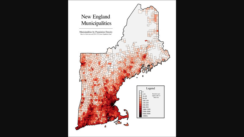
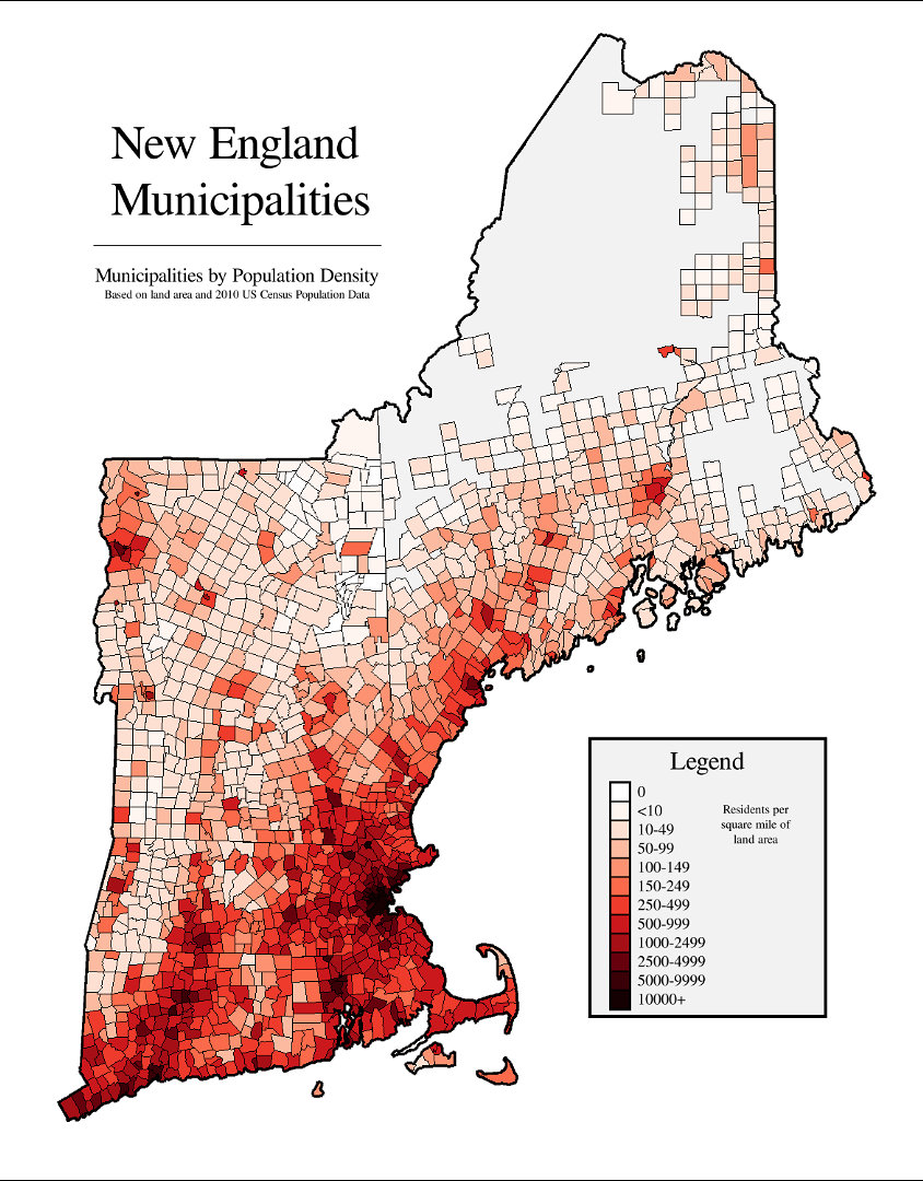
New England Population Density By Town – Municipalities
Although the following map is sourced from 2010 data, it’s likely very proportionally close to today’s data.
The most populous cities in New England
As of the 2020 census…
- Boston, Massachusetts: 675,647
- Worcester, Massachusetts: 206,518
- Providence, Rhode Island: 190,934
- Springfield, Massachusetts: 155,929
- Bridgeport, Connecticut: 148,654
- Stamford, Connecticut: 135,470
- New Haven, Connecticut: 134,023
- Hartford, Connecticut: 121,054
- Cambridge, Massachusetts: 118,403
- Manchester, New Hampshire: 115,644
- Lowell, Massachusetts: 115,554
- Waterbury, Connecticut: 114,403
The most population dense county in New England is Suffolk county (Boston) with 13,180 people per square mile. Worse yet, the Chelsea subdivision within Suffolk county (directly across the Mystic River from the city of Boston) boasts 17, 263 per square mile! Wow, that’s a lot of people density!
Whereas I also live in New England, my county in New Hampshire ranges from zero people per square mile, to about 17 averaged across the entire county. Looking at my own 1/4 mile square (about 30 acres), it looks like it’s just two of us – me, and Mrs.J (and our dog – oh, and usually several bears, 4 – 6 whitetail deer, the howling coyotes, fox, bobcat, dozens of turkeys, the wood chuck, the snow-shoe hares, red and gray squirrels and chipmunks, porcupines, skunks, raccoons, and… oh wait a minute — they don’t count on the census!). I only say this to point out the dramatic differences – depending where you live.
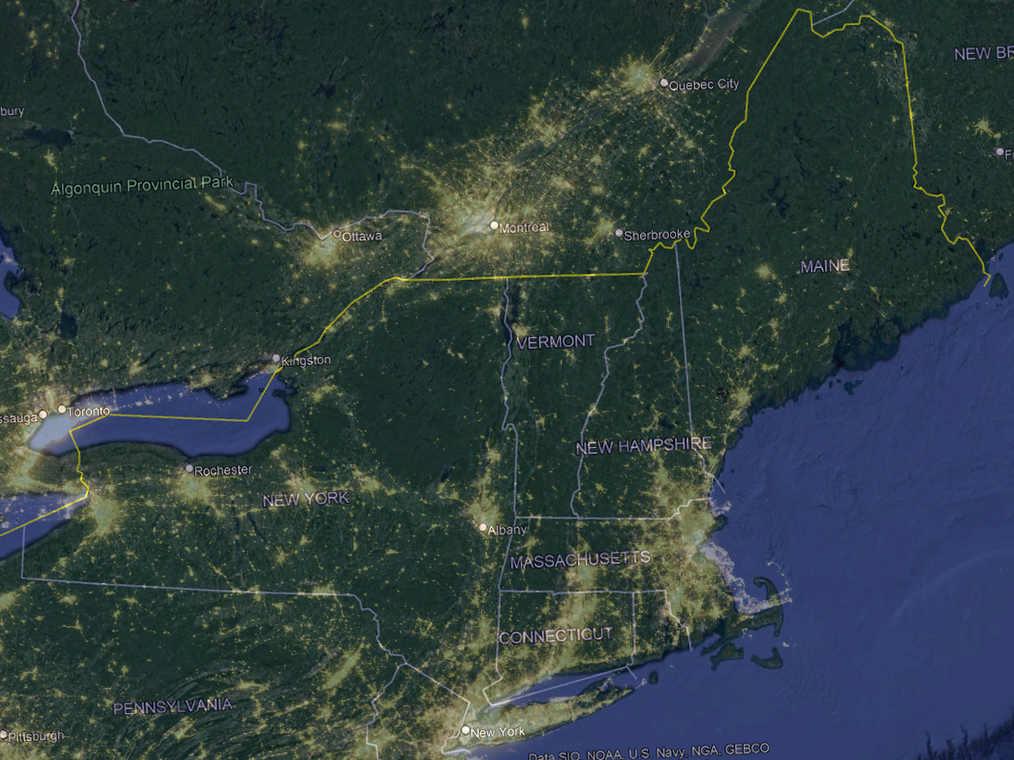
Northeast – New England Population Density – Satellite Lights At Night
Here’s another way to look at New England population density. I put together a map that overlays the state boundaries (google earth) blended with a pretty interesting satellite image at night. The night lights of the populous regions puts perspective on population density versus geographical area.
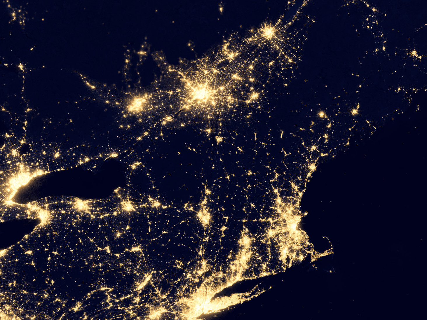
Here’s an image of just the satellite view at night (no state line boundaries for reference)…
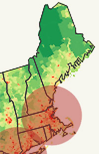
Given survival and preparedness, southern New England is certainly a zone of risk should there be a SHTF breakdown of societal order. However it is interesting to overlay 200-mile diameter zones over the Boston and NYC region, a distance that some may consider to be the maximum typical ‘reach’ of negative influence during a societal collapse.
There are lots of rural low population regions in Vermont, New Hampshire, and Maine. In fact nearly all of those states are quite rural. On the other hand, Massachusetts, Connecticut, and Rhode Island are packed with people. While the majority of those states are shoulder to shoulder quaint New England towns, each with their charm, there are still lots and lots of people.
From a prepping and preparedness point of view, the northeast is not necessarily an ideal solution for insulation from risks during a SHTF societal collapse, when comparing to other choices within the entire country. While there are plenty of rural regions in central and northern New England with low population density, the growing season is short. The winters are cold and longer. Some of the terrain is rough and rugged. But you can make it work. Adapt and Overcome, right?
It is a beautiful place though, once you’re out of the city regions (unless you happen to like city living – which apparently many do. It’s just not for me). New England’s four seasons each bring their own unique beauty. Consequently the weather is always changing. We get it all here. I’ve been (almost) all over the country in my travels over the years. There are so many unique, beautiful, fantastic places in the United States.

[ Read: The Zombie Hordes Distance From Cities ]
[ Read: Survival Retreat Population Density ]
