Alternate Routes During Evacuation or Bug out

Most people don’t think about alternate routes. Instead they drive the same routes and roads everywhere they normally go. Those frequently traveled roads are typically the quickest to their destination and are the roads well traveled by most people in vehicles.

However if something were to happen that clogs the mainstream routes into traffic jams, would you know alternate routes to get to where you’re going?

During an evacuation or bug-out, will the masses choose the popular main routes and roads that are most often traveled?

Answer: YES. People are mostly creatures of habit. Most exhibit symptoms of normalcy bias, and a lack of good situational awareness and critical thinking ability during times of stress of crisis.

People, just, freak out. Panic.

Be Smart – Have Alternate Routes

As a preparedness-minded critical thinking person yourself, you can outsmart the mainstream masses by having a preconceived evacuation or bug out plan of alternate routes including options for multiple destinations.

Tip: If you do not have any alternate routes out of your immediate area, then focus on how you might handle it. Think about timing. Consider what may block your path and what you might do to mitigate those issues. Maybe it’s time for that helicopter… Or, do you live on or near the water? Maybe a boat? There’s always the bicycle… Maybe you will have to stay put. Then what? Are your prepared?

Here’s one that may be helpful during normal day-to-day travel: How many alternate driving routes do you know from your place of work to home? If the balloon goes up and you need to get home, which route are you going to take?

Or this one: If there is an evacuation (e.g. hurricane warning), how many alternate driving routes do you know that will bypass around the clogged masses sitting in traffic jams on the major roads, freeways, highways, and interstates?

Planning Alternate Routes

The discussion here is NOT about whether or not to evacuate or bug out. Rather it is about after one makes the decision to get out…

Consider the following while planning alternate routes:

Use Hard Copy Maps to find Alternate Routes

Keep a road atlas or maps of your state and surrounding states where you might travel. I feel that it’s important to have hard copy maps or road atlas, so that you can identify alternate roads that are less traveled by the mainstream. A hard copy printed map gives you a MUCH BETTER bigger picture when viewing alternate routes compared to GPS screens.

Supplement your atlas or state maps with the more detailed information such as local county or town maps. Some of them also show structures (houses, etc..). Do a internet search for your area which may turn up such a map…

A alternate route will likely not be a straight line to your destination (and may actually be significantly longer in distance). But the fact that you’re avoiding the clogged traffic jam will help assure that you get to your destination.

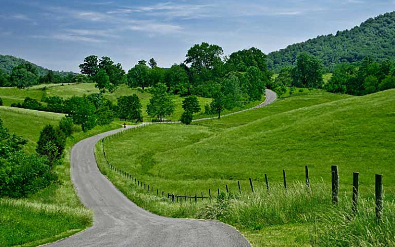
Ignored Roads are Great Alternate Routes

Neighborhood streets and secondary roads will be largely ignored by the mainstream.

Choke Points | Avoid Them!

Avoid parts of routes which may bottleneck in places where other main roads or highways intersect, such as those with a major on-ramp or off-ramp to a freeway or cornering with a major route. In a disaster, people may be clogged trying to get on or off in these locations.

Lots of Traffic Lights

If a road has traffic lights, it’s a road frequently traveled. Roads with fewer or no traffic lights are those less traveled in general.

Forgotten Roads Off The Beaten Path

There are often lesser known ‘shortcuts’ through the countryside, older roads which once were main routes and have mostly become forgotten.

GPS | They’re Good, to an extent

GPS can be very helpful, but be sure to keep street-level maps of your region and learn the routes of travel without reliance upon GPS.

Full Tank of Gasoline!

Get into the habit of maintaining a mostly full gas tank (don’t let it go below half a tank). Once you’ve established that habit your vehicle will always have a decent range (miles down the road) in the event of a sudden bug out. Most vehicles can make it 300 – 400 miles on a full tank, or more – depending. For example my truck’s range is 680 miles on a full tank of diesel…

 
SUMMARY
Regardless of where you live, everyone should have a plan to evacuate their home region with multiple alternate routes and destinations in mind. Also know several alternate routes home from your place of work. Make a plan now and you can check off another box for your preparedness. Not only that, but driving alternate routes can be enjoyable with new sites, scenery, and a sense of exploration.

Bugging Out | Will You Make It To Your Destination?

Post SHTF |Walking Along Railroad Tracks

Don’t forget to keep a 72-hour emergency kit in the vehicle too…

24 Comments

  1. Folks talk about “snowflakes” quite a bit and I fully understand the implications behind the term, but “oblivious” and “clueless” also describes a significant segment of the population. Devoid of “common sense” and inability to use “deductive reasoning” also fits.

    During my years in law enforcement, it was often necessary to shut down and divert traffic on a street or highway. Many times this would neighborhood residential streets. In most cases, these neighborhoods would laid out in a checkerboard fashion.

    It was almost amazing, if not both comical and sad, how many people that had lived in the same house for multiple years, that did not know until you explained it to them, that they could take a left, go one block, take a right and go another block and turn right (or take a right, then a series of left turns) to get back on the same street they were on. I can’t tell you how many times I’ve had both men and women, sometimes with panic, fear, and tears in their eyes tell me that I had to let them go straight (through the hazard that precipitated the road closure), because “that’s the only way you can get to my house!”

    And yes, these are the people you will be contending with when there is a real disaster.

  2. i drove for a living for about five years so i HAD to learn other routes around this city and every time i have moved i have LOOKED FOR OTHER routes out of this city many a time i have managed to get around traffic jams hopefully i will NEVER HAVE to use the other routes to get out here when i have driven friends around they sit there mind boggled how i figured out to get someplace when i have never been there it really quite simple if you think about it IF YOU KNOW WHAT ROADS GO WHAT WAY and how long the road is its dead simple but then most people dont think outside the box like i do

    1. When I used to live in Texas, I would take a back highway from home to the office. There was a bigger main highway that would take me to the same place. The back highway speeds were lower but since there wasn’t very much traffic, a significant amount of time was shaved off my commute. Well, like all good things, that came to an end. As more and more people found out about the back route, traffic got worse and worse until it took longer to get to work the back route than taking the main highway which took me through a town and multiple stop-lights.

  3. Ditto on the GPS. I’ve been lead into a dead end by following it’s directions and often, even with updated maps, I will be driving down a road that a isn’t displayed on the screen. You can’t even use them to scrape ice off the windshield.

    1. I have often heard coming from the GPS device:

      “I can no longer help you.”

    2. the last time I used GPS was many years ago when taking my wife to the airport. The darn GPS kept telling me to exit now, exit now. Well, there was a 25 foot concrete wall on my right preventing me from exiting. After that, I use google maps and look the route over in greater detail in the map before printing out zoomed-in important change points such as when I have to be in the third lane to exit highway because if I am in the second lane, I will get onto another wrong highway or the fourth lane which will keep me on the same highway currently on.

  4. If you have a pickup, get a bed mounted auxiliary tank! For pulling our 5th wheel with my 2008 Ford F-350 diesel, I had a 75 gal tank installed to replace the original tank and then added a 100 gallon bed tank that is connected to the fuel system. So with 175 gallons of diesel, we can travel at least 1,575 miles ( 9 miles per gallon) with the 5th wheel attached, and up to 2,450 miles (at 14 miles per gallon) with the pickup alone. Add to that the space in the bed to secure up to 6 X 6 gallon containers of fuel, we don’t need a fill up until we at least get to Seattle, WA from Central PA, on our way to AK, or still have PLENTY of fuel left after reaching our favorite camping spot in NW Maine.

    Oh yea, forgot to mention the fact that I carry two “siphon” hoses, the type with a built in starter bulb… just in case we would encounter a “disabled” 18 wheeler that no longer needed those large fuel tanks full of diesel.

    1. LEO2211,
      That sounds very intriguing. I too pull a 5th-wheel. So your external tank (the one in the bed) fit okay with the 5th-wheel hitch and clearance and such?

      I drive an F350. I hadn’t though about replacing my existing 38 gallon tank with a bigger one (I’m going to look into the cost of that…).

      1. Ken, no issues with the bed tank, it is a dually so no weight issues, and the style have is flush with the bed. There are many different configurations available, check them out. Cost of the replacement for the OEM was high, about $1,200 with install.

    2. I too have a bed mounted 100 gal. tank/tool box combination for my f350. But I have a bumper pull trailer, so clearance is not an issue.
      The only problem is, I am where I would want to escape to (ID panhandle). But the fuel is great for filling the truck as needed and the skid steer. And I can shop for fuel based on price rather than need.

      1. Id. Panhandle. My lifelong home. Glad to have you here. I live in the bigger city up here, but I don’t think I’ll be going to far. As far as alternate routs go, if I have to go, I have them all memorized. Who knows. It’s growing so much up here, I may have to leave.

  5. I always carry our ORV atlas of our state, especially when we are camping.
    It is quite well detailed, more so than a state map, showing creeks, small lakes, burbs, then of course ORV/snowmobile routes.
    I’m not sure how many states would have this type of atlas option.

    1. Joe,

      I think all of the states have a book of maps such as this. Another good resource is the USGS. (United States Geologic Service.) You can get detailed contoured topographical maps showing much more detail. They show roads, trails, creeks, rivers, lakes, pipelines, railroads, mountains, water towers, mines, buildings, gravel pits, place names… They are available in 7 1/2 minute, 15 minute, and 30 minute maps, depending on how much detail you want. You can order them by mail or get from a sporting goods store. There is (or was) a mountaineering store in Cody that had the capability to print out whatever map you want. In order to orient yourself to location within the state they have a little box showing the adjacent maps and the location within the state. Also the name of the next map is printed on the top, bottom and edges of each map, so you can fit the various maps together. The maps also have the latitude and longitude and contours showing the elevations.

      If you know the location you are relocating to, it would be a good idea to have all the maps surrounding your new location and the maps between your current home and your bug-out location. Cheap insurance.

      1. i’m sure it was just a slip, but it’s,” United States Geological Survey”. thank you for your generous contributions to “our” site!

  6. Google Map
    Pull up your area and zoom in a little, tis amazing how many Cow Pastures have roads/paths in the sides that will allow you to get from there to here.
    Make sure to close the gate if closed.
    Also many of Right-of-Ways are not shown on maps, Gas Lines, Power Lines, old forest roads and the like normally are not on a “Map” but are a GREAT way to get-around Traffic.

    Anyone know how many stalled vehicles it takes to stop traffic? In the town I work we have 3 main roads that are accesses to here, 3 wrecks and the entire place is shut down. Now toss in the panic of the wacko’s and what ya got? Instant SHTF.

  7. – To get out of the small city where I work, I either have traveled or know the general direction of flow for more roads than I can count. Once out of town, there is one main road that everyone uses.

    I know of and have traveled two others that will take me to home without incident. In addition to that, I know of two stream courses that pass within a reasonable distance of my home. These would provide hopefully water and shade for all but about fifteen miles either way should I have to use them. The “better” of the two passes through ranchland; I have traveled a good bit of it.

    The other, I have hunted in that area, to include walking a good bit of that route and I know the owners (including the ones I really wouldn’t want to run into, d/t their “Side Enterprises”, AKA marijuana farming)

    I actually think I would stand a pretty good chance of getting through either route. Just examples of the kind of obstacles you may find going cross-country, though.

    – Papa S.

    1. – Alternate paved roads, the shortest is about half again longer; the other is a bit more than twice as far. That’s the price of living Rural. Both cross country routes are around 60 miles. Just FWIW.
      – Papa S.

  8. Finding routes suck if you live somewhere populated or the terrain is unfavorable.

    Pretty much every route I have between home and work that doesn’t take more than double the distance has some kind of choke point. I consider a choke point something that a 4wd/awd vehicle equipped with either locking, limited slip, or brake-controlled traction aiding device with at least 10″ of ground clearance that you don’t care about body damage to be a limiter.

    I have taken some really unorthodox ways home due to bad weather and other human-caused insanity. But they all take a lot more miles.

    Even the electric transmission (car size boulders blocking access on purpose) and railways (bridges of track and no wheeled vehicle capable crossties) have choke points.

    My mud truck on 44″ Boggers has lots of options. But at about 20mph the tires are very loud so you can hear it coming like a semi driving on the rumble strips. And since it is designed for trail use it has plenty of spare parts on it plus self-recovery equipment but it has very limited cargo carrying capability. Like a Smart Fortwo.

  9. Living in the country and mostly all county roads I can travel to and from work. Just take the next section.
    But for instance, a flood. We are surrounded by bridges.
    Back in ’86 we had a week’s worth of heavy rain. The river bridges had water overflowing the roadways. I could have taken the long way around to pick up then wife from work
    nope….took the shortest route. Hydroplaned across the roadway, as I sat in the ditch, I watched my brother, who worked nights, drive right on by me, in his pickmeup truck. Or the bridge I crossed, in the ’79 Duster, where the flowing river must have been a couple feet above the road.
    We made ‘er….
    .,..took an alternate route back home from leaving folks.

    Ahh…..
    can I be young and dumb again? Life was so much more entertaining…..

    1. Joe c

      Watched a YouTube video a few years ago. Pickup truck headed into a couple inches of water flowing over the road. Took less than a second for the truck to disappear under rough muddy water that had completely erased the culvert that normally carried a small stream. Scary! Haven’t driven through running water since.

  10. Around here, and I’ve noticed elsewhere, there are a good number of field roads that you wouldn’t find on any map or certainly not on GPS on which you can travel considerable distance from town to town. Also in that category of uncharted roads ATV and snowmobile trails. Cross country ski trails sometimes coincide but rarely by themselves are adequate for full size vehicle use. Snowmobile trails almost always are routes to bars, cafes.

  11. Living rural has some big advantages when it comes to traffic congestion. The problem is i only have one direction that doesn’t have to cross a river within 12 miles. To me these are the most serious choke points.

  12. When driving and picking routes look at your obvious choke points and not so obvious ones.
    Bridges, overpasses especially the hills attached, sharp curves, construction zones in S curve shape or reductions.
    Natural ones like high sided cliffs, low water crossings and trees easily felled.
    Cable barriers on our state have made fatal funnels.
    Watch where police officers sit. That’s where vision is limited and hides are.
    One thing that was brought up too is the sound. Tire and engine noise are give aways. Mudders and glasspacks can draw in more than dates.

  13. I live in Alaska and work in town. Going to work is driving in a big chokepoint–one way in and out. In my bug-out bag I carry what I need to get home in the mountains. So I figured out a plan to walk home, depending on the season, to avoid streets and population. It may take me 2 up to 3 days, but beats the shelters.

    In Alaska, we always have stored supplies of food (including clean water), clothing (for all seasons), and backup emergency shelter, and heat (plus emergency medical and other supplies. We had a 7+ earthquake this year and there were 1000+ homes uninhabitable.

    We depend upon weekly barge service for food and related supplies. If you have a strike in Seattle or Tacoma, or a natural disaster in the lower 48, the store shelves will be cleaned out in a week. So you better be prepared, and a lot nowadays are not.

Comments are closed.